|
|
ARBUCKLES' ILLUSTRATED ATLAS
of
Fifty Principal Nations of the World
(Actual Size: 6-7/8" x 11-1/8" - shown approx. 1/2 scale)
CLICK on any map to see the
corresponding card as it was originally issued. |
 Ireland, Japan, Central Africa, India Ireland, Japan, Central Africa, India

(facing page)
|
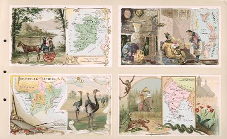
IRELAND.
IRELAND, known to the Greeks by the name Ierne
(Erin) and to the Romans by the name Hibernia,
is the second largest of the British
Isles, and is washed on the N. W. and S.
sides by the Atlantic Oceand and
separated from Great Britain by the N.
Channel, the Irish Sea and St. George's
Channel. Dublin, the capital, first
mentioned by Ptolemy, is one of the
finest cities in the Empire, and is
situated at the head of Dublin Bay. A
Lord Lieutenant is head of the executive
government, and is assisted by a Privy
Council and Chief Secretary.
Area,
32,531 square miles; population 1881,
5,174,836. Between 1853 and 1889
2,289,735 Irish emigrants landed in the
United States.
The great
central portion of Ireland is flat, and
not less than 2,830,000 acres is bog, but
much of the soil is of singular
fertility. The climate is milder and
moister than that of Great Britain, and
clothes the plains and valleys with the
richest pasture, procuring for Ireland
the name of the Emerald Isle.
The coast
inlets, called Loughs, are many and of
great extent. The lakes of Killarney,
three in number, in Kerry, and under
shadow of the loftiest mountains in the
island, are widely famed for their
romantic beauty.
The chief
crops are wheat, barley, oats, potatoes,
beans, peas. The live stock comprises
horses, cattle, sheep and pigs. The most
important manufacture is that of linen.
Other industries are muslin sewing, lace
making and woolen and worsted goods.
There is a considerable amount of whisky
distilling and porter brewing. The
Shamrock (trefoil) is the national badge
of Ireland.
|
JAPAN.
JAPAN
(Niphon, "land of the rising sun")
is an insular empire in the E. of Asia,
comprising the four large islands of
Niphon (the Japanese mainland), Sikok,
Kiusiu and Yesso, and as many as 3,500
smaller ones, including the Kurile
Islands.
The
system of government of the Japanese
Empire was that of an absolute monarchy.
A Constitution was, however, promulgated
on February 11, 1889. By it the Emperor
is the head of the Empire, combining in
himself the rights of sovereignty and
exercising the whole of the executive
powers, with the advice and assistance of
the Cabinet Ministers. There is also a
Privy Council. The Emperor exercises the
legislative power, with the consent of
the Imperial Diet, consisting of two
Houses.
Area,
146,544 square miles; population,
33,623,379.
The
climate varies greatly, but in the
central part is generally mild and
agreeable. The land is cultivated chiefly
by peasant proprietors, tenancy being
rare. The Japanese are good
agriculturists and pay great attention to
irrigation, manures and the rotation of
crops, and their soil, a fertile friable
loam, is chiefly under tea and rice, but
other products are cotton, tobacco,
wheat, maize, potatoes and vegetables.
Fruits are abundant. The mineral wealth
is great, and the waters abound in fish,
which, in addition to rice, forms the
staple food of the people.
The
Japanese are singularly skillful in the
manufacture of silks and cottons, and are
unsurpassed for the exquisite beauty of
their porcelain, lacquer work and
bronzes. The Japanese are an agreeable,
sprightly, polished people; ingenious,
clean and frugal.
|
|
CENTRAL AFRICA.
CENTRAL
AFRICA contains several semi-barbarous
independent States, the Sultans of which
are, in principle, absolute monarchs.
These States are, the CENTRAL SOUDAN
STATES, Bornu and Wadai; RUANDA, in the
equatorial lake region, and LUNDA, to the
east of the Portugese African Colonies.
Under this head may also be included the
old Egyptian Soudan.
Bornu
is the most populous Mohammedan State in
Central Soudan, and occupies the western
and southern sides of Lake Tsad. Wadai is
at present the most powerful State in
Central Soudan, and has several vassal
States. The Arabs have been settled in
the country for over 500 years. Their
traders send caravans south and west
bartering salt and manufactured goods for
ivory, slaves, ostrich feathers and
copper; but the political power is in the
hands of the Mohammedan Mabas, a negro
people.
DAHOMEY
has in recent years been greatly reduced
in size and strength, and will probably
soon be annexed to France. The natives
are of pure negro stock, and fetish
worshippers, and are industrious
agriculturists.
The
LUNDA EMPIRE is still the largest and
most populous in the whole of the Congo
basin. Its ruler is suzerain of about 300
vassal chiefs and kinglets, who pay
tribute in kind-ivory, lion and leopard
skins, corn and salt. The chief exports
are ivory and slaves.
The
CONGO FREE STATE was placed under the
sovereignty of the King of the Belgians
by the International Congo Conference,
and declared neutral and free to the
trade of all nations.
The
principal exports of CENTRAL AFRICA are
palm oils, India rubber, gum copal,
ground nuts, ivory, coffee and cam-wood.
|
INDIA.
INDIA
is the geographical term applied to the
central peninsula of Southern Asia, which
is bounded on its landward base by the
Himalaya Mountains and the rivers Indus
and Brahmaputra.
Here,
the word India will be understood in its
modern political signification, as
comprehending the entire region over
which Queen Victoria exercises supremacy
as Empress of India; excluding Ceylon and
the Straits settlements of Singapore,
&c., the administration of which is
in the hands of governors, under control
of the Secretary of State for the
Colonies, and not of the Indian
Government.
The
executive authority is vested in a
Governor-General (appointed by the Crown,
and acting under order of the Secretary
of State for India), and assisted by a
Council of not less than 10 members.
The
total area is 1,425,700 square miles. The
population 255,000,000.
The
physical aspect is extremely varied, and
represents the grandeur of tropical
phenomena on a most impressive scale. The
Himalaya Mountains exhibit both the
loftiest peaks and the highest level of
elevation in the world. The delta formed
by the confluence of the Ganges and the
Brahmaputra, is perhaps the most fertile
spot in the world.
The
climate is thoroughly tropical, except in
the most favored hill stations.
The
chief industry has always been
agriculture. Rice, millets, barley,
wheat, grain and maize form the staple
food-grains. Fruit trees, vegetables and
spices abound. The commerce and trade is
very large and annually increasing.
Exports include raw cotton, yarn, opium,
wheat, rice, jute, tea, coffee and
indigo.
Calcutta,
the city of palaces, is the residence of
the Governor-General, and the greatest
Eastern commercial centre.
|
|